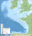
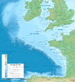
Fail:Celtic Sea and Bay of Biscay bathymetric map-en.svg
Kokitanan

Saiz pratonton PNG bagi fail SVG ini: 548 × 599 piksel . resolusi suai: 219 × 240 piksel | 439 × 480 piksel | 702 × 768 piksel | 936 × 1,024 piksel | 1,872 × 2,048 piksel | 3,479 × 3,805 piksel.
Fail sandad (Pail SVG, tipong tuou 3,479 × 3,805 piksol, ginayo pail: 4.93 MB)
Sajara fail
Todoso id kalindo / maso do mongintong di upa dilo fail ontok di timpu nokomoi.
| Tadauwulan/Maso | Sinondulu | Ginayo | Moomomoguno | Komi | |
|---|---|---|---|---|---|
| timpu diti | 05:33, 29 Gumas 2019 |  | 3,479 × 3,805 (4.93 MB) | Sting | New map using GEBCO 15 Sec topographic data ; rivers from ECRINS ; added names |
| 22:34, 3 Madas 2014 |  | 1,749 × 1,913 (673 KB) | Erigena | minor tweaks | |
| 20:46, 1 Madas 2014 |  | 1,749 × 1,913 (614 KB) | Erigena | User created page with UploadWizard |
Pomogunaan do fail
Iti kiharo bolikon poingoput id pail diti:
Pomogunaan fail sompomogunan
Fail diti ginuna do wiki suai:
- Kopomogunaan id af.wikipedia.org
- Kopomogunaan id azb.wikipedia.org
- Kopomogunaan id bg.wikipedia.org
- Kopomogunaan id bh.wikipedia.org
- Kopomogunaan id bn.wikipedia.org
- Kopomogunaan id cs.wikipedia.org
- Kopomogunaan id de.wikipedia.org
- Kopomogunaan id en.wikipedia.org
- Kopomogunaan id en.wikiversity.org
- Kopomogunaan id fa.wikipedia.org
- Kopomogunaan id fi.wikipedia.org
- Kopomogunaan id frr.wikipedia.org
- Kopomogunaan id fy.wikipedia.org
- Kopomogunaan id hif.wikipedia.org
- Kopomogunaan id hu.wikipedia.org
- Kopomogunaan id hy.wikipedia.org
- Kopomogunaan id hyw.wikipedia.org
- Kopomogunaan id id.wikipedia.org
- Kopomogunaan id ja.wikipedia.org
- Kopomogunaan id lo.wikipedia.org
- Kopomogunaan id lv.wikipedia.org
- Kopomogunaan id nl.wikipedia.org
- Kopomogunaan id ru.wikipedia.org
- Kopomogunaan id sq.wikipedia.org
- Kopomogunaan id sr.wikipedia.org
- Kopomogunaan id sv.wikipedia.org
- Kopomogunaan id tg.wikipedia.org
- Kopomogunaan id th.wikipedia.org
- Kopomogunaan id tr.wikipedia.org
- Kopomogunaan id uk.wikipedia.org
- Kopomogunaan id vi.wikipedia.org
- Kopomogunaan id vls.wikipedia.org
- Kopomogunaan id www.wikidata.org
- Kopomogunaan id zh-min-nan.wikipedia.org
- Kopomogunaan id zh-yue.wikipedia.org
- Kopomogunaan id zh.wikipedia.org


