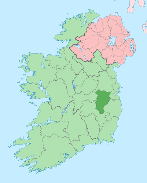
Fail:Island of Ireland location map Kildare.svg
Kokitanan

Saiz pratonton PNG bagi fail SVG ini: 481 × 599 piksel . resolusi suai: 192 × 240 piksel | 385 × 480 piksel | 616 × 768 piksel | 822 × 1,024 piksel | 1,643 × 2,048 piksel | 1,450 × 1,807 piksel.
Fail sandad (Pail SVG, tipong tuou 1,450 × 1,807 piksol, ginayo pail: 642 KB)
Sajara fail
Todoso id kalindo / maso do mongintong di upa dilo fail ontok di timpu nokomoi.
| Tadauwulan/Maso | Sinondulu | Ginayo | Moomomoguno | Komi | |
|---|---|---|---|---|---|
| timpu diti | 17:12, 3 Madas 2020 |  | 1,450 × 1,807 (642 KB) | Chipmunkdavis | Per the Local Government Reform Act 2014, joining both Tipperarys and both Waterfords (and removing Limerick City code). Colouring in islands, cleaning up and grouping code to remove stray objects and show Galway and Lough Ree. |
| 08:48, 19 Madas 2010 |  | 1,450 × 1,807 (815 KB) | Mabuska | {{Information |Description={{en|The island of Ireland, showing international border between Northern Ireland and Republic of Ireland, traditional provinces, traditional counties, and local authority areas in the Republic of Ireland and Northern Ireland.}} |
Pomogunaan do fail
Iti kiharo 2 bobolikon poingoput id pail diti:
Pomogunaan fail sompomogunan
Fail diti ginuna do wiki suai:
- Kopomogunaan id ar.wikipedia.org
- Kopomogunaan id ast.wikipedia.org
- Kopomogunaan id be.wikipedia.org
- Kopomogunaan id bg.wikipedia.org
- Kopomogunaan id ca.wikipedia.org
- Comtat de Kildare
- Naas
- Maynooth
- Leixlip
- Plantilla:Comtat Kildare
- Athy
- Newbridge (Kildare)
- Kildare
- Curragh
- Turó d'Allen
- Monasterevin
- Castledermot
- Calverstown
- Allen (Kildare)
- Kilcullen
- Ballymore Eustace
- Rathangan (Kildare)
- Prosperous
- Allenwood
- Caragh
- Clane
- Kill (Kildare)
- Kilcock
- Baile Eoin
- Baile an Mhuilinn (Kildare)
- Kopomogunaan id ceb.wikipedia.org
- Kopomogunaan id cs.wikipedia.org
- Kopomogunaan id da.wikipedia.org
- Kopomogunaan id en.wikipedia.org
Intangai lobi momomoguno sompomogunan do pail diti
