
Fail:Malay language Spoken Area Map v1.png
Ingaa pinosodia risoluson takawas.
Malay_language_Spoken_Area_Map_v1.png (333 × 154 pipisil, sais pail: 4 KB, nuludan MIME: image/png)
Koinibaan

|
This linguistic map image could be re-created using vector graphics as an SVG file. This has several advantages; see Commons:Media for cleanup for more information. If an SVG form of this image is available, please upload it and afterwards replace this template with
{{vector version available|new image name}}.
It is recommended to name the SVG file “Malay language Spoken Area Map v1.svg”—then the template Vector version available (or Vva) does not need the new image name parameter. |
| pongowowoyoon |
English: This is crop and edit of a .png export of the image at File:BlankMap-World6.svg. The original author released that image into the public domain for any use. This version is released under the CC-Zero license. |
| Tadau Wulan | 13 Mansak 2011 (original upload date) |
| kowonuan | Transferred from en.wikipedia to Commons by Zscout370 using CommonsHelper. |
| Sanganu | True at Inggeris Wikipedia |
Pongolisinan
Dengan ini, True at Inggeris Wikipedia selaku pemegang hak cipta karya ini, menerbitkannya di bawah lesen yang berikut:
| Fail ini disediakan di bawah Dedikasi Domain Awam Sejagat CC0 1.0 Creative Commons. | |
| Pihak yang mengaitkan karya ini dengan surat ikatan ini telah mendedikasikan karya ini kepada domain awam dengan melepaskan segala haknya kepada karya ini di seluruh dunia di bawah undang-undang hak cipta, termasuk semua hak berkaitan dan berjiran, sejauh mana yang dibenarkan oleh undang-undang. Anda boleh menyalin, mengubah suai, mengedarkan dan mempersembahkan karya ini, termasuk untuk tujuan komersil, semuanya tanpa meminta kebenaran.
|
Log muat naik asal
The original description page was here. All following user names refer to en.wikipedia.
- 2012-02-20 03:34 Kwamikagami 333×154× (4555 bytes) correct area in Thailand, add Cocos Isl.
- 2012-02-20 03:17 Kwamikagami 333×154× (4570 bytes) Reverted to version as of 23:23, 13 February 2011
- 2011-09-14 23:58 Niduzzi 736×386× (33038 bytes)
- 2011-02-13 23:23 True 333×154× (4570 bytes) This is crop and edit of a .png export of the image at http://en.wikipedia.org/wiki/File:BlankMap-World6.svg. The original author released that image into the public domain for any use. This version is released under the CC-Zero license.
Sajara fail
Todoso id kalindo / maso do mongintong di upa dilo fail ontok di timpu nokomoi.
| Tadauwulan/Maso | Sinondulu | Ginayo | Moomomoguno | Kumin | |
|---|---|---|---|---|---|
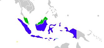
| timpu diti | 08:23, 25 Mansak 2022 | | 333 × 154 (4 KB) | Kwamikagami | no longer a map of where Malay is spoken |
| 05:52, 26 Gumas 2018 |  | 4,387 × 1,922 (336 KB) | Bennylin | Edit some colors | |
| 05:40, 26 Gumas 2018 |  | 4,300 × 1,918 (535 KB) | Bennylin | Change ugly map with PNG version of File:Maritime South East Asia.svg | |
| 04:51, 21 Mahas 2012 |  | 333 × 154 (4 KB) | File Upload Bot (Magnus Manske) | Transfered from en.wikipedia by User:zscout370 using CommonsHelper |
Pomogunaan do fail
Iti kiharo 2 bobolikon poingoput id pail diti:
Pomogunaan fail sompomogunan
Pail diti ginuna do wiki suai:
- Kopomogunaan id ckb.wikipedia.org
- Kopomogunaan id el.wikipedia.org
- Kopomogunaan id en.wikipedia.org
- Kopomogunaan id es.wikipedia.org
- Kopomogunaan id fa.wikipedia.org
- Kopomogunaan id frr.wikipedia.org
- Kopomogunaan id id.wikipedia.org
- Kopomogunaan id incubator.wikimedia.org
- Kopomogunaan id mi.wikipedia.org
- Kopomogunaan id nl.wikipedia.org
- Kopomogunaan id zh.wikipedia.org